-
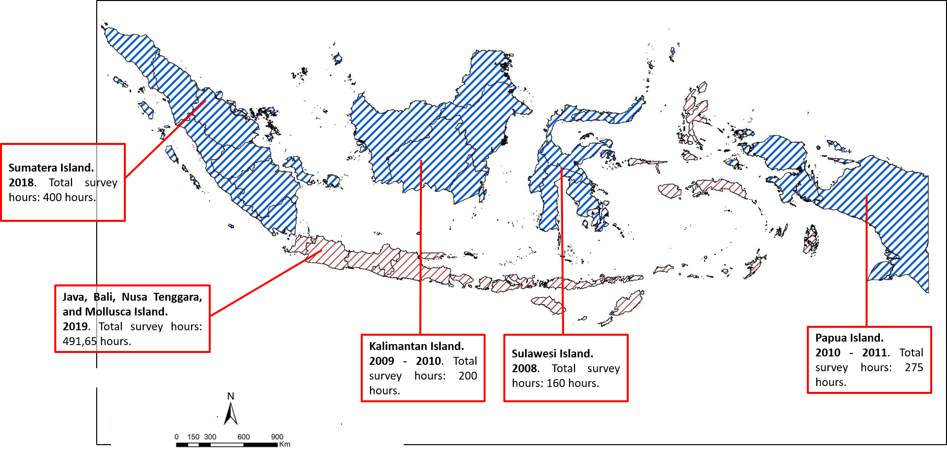
Airborne gravity measurement is a relative gravity measurement method that observes changes in relative gravity along a straight flight trajectory, and these relative observations are a known absolute gravity value (point) referenced to the ground. The survey requires the use of a specific instrument called an aerial gravimeter. The Geodesy Control Network and Geodynamics Center of the Indonesian Geospatial Information Agency (BIG) used the La Coste & Romberg AirSea Gravity (S- 99) Carried out an aerial gravimetric survey plan for parts of Indonesia. The survey was restarted in 2018, using the La Coste & Romberg AirSea II air gravimeter (S-130) managed by the Department of Land Affairs of the Ministry of the Interior of Taiwan and the GT-2A air gravimeter owned by BIG, and planned to investigate the complete Indonesian territory.
/