
The main purposes of spatial analysis include:
Understanding of the meaning of space
A description of the spatial pattern
Discussion on the causes of existing spatial patterns
Estimates of possible changes in spatial patterns
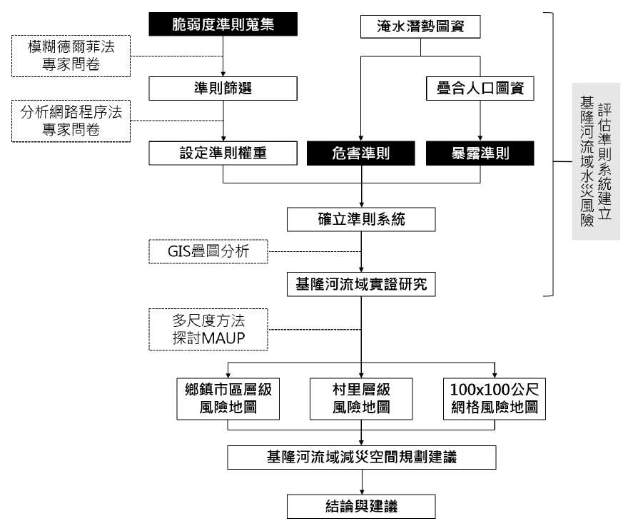
In the process of spatial analysis and disaster management, taking the study of "the construction of a basin-scale flood risk assessment system with the Keelung River Basin as a demonstration area" as an example, using questionnaire surveys, the Fuzzy Delphi Method (FDM) and Analytical Network Process ( ANP), for experts and scholars in various fields such as industry, government, and academia to construct a basin-scale flood risk assessment system with the Keelung River Basin as a demonstration area (as shown in the figure below).
Geographic Information System (GIS) can also be used to perform overlay analysis, integrate landscape index and statistical analysis, and explore the relationship between the spatial distribution of different urban land uses and the relationship between flooding depth and area during different years.
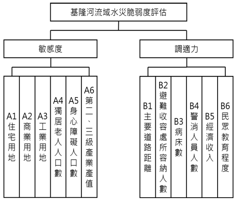
Vulnerability factor indication
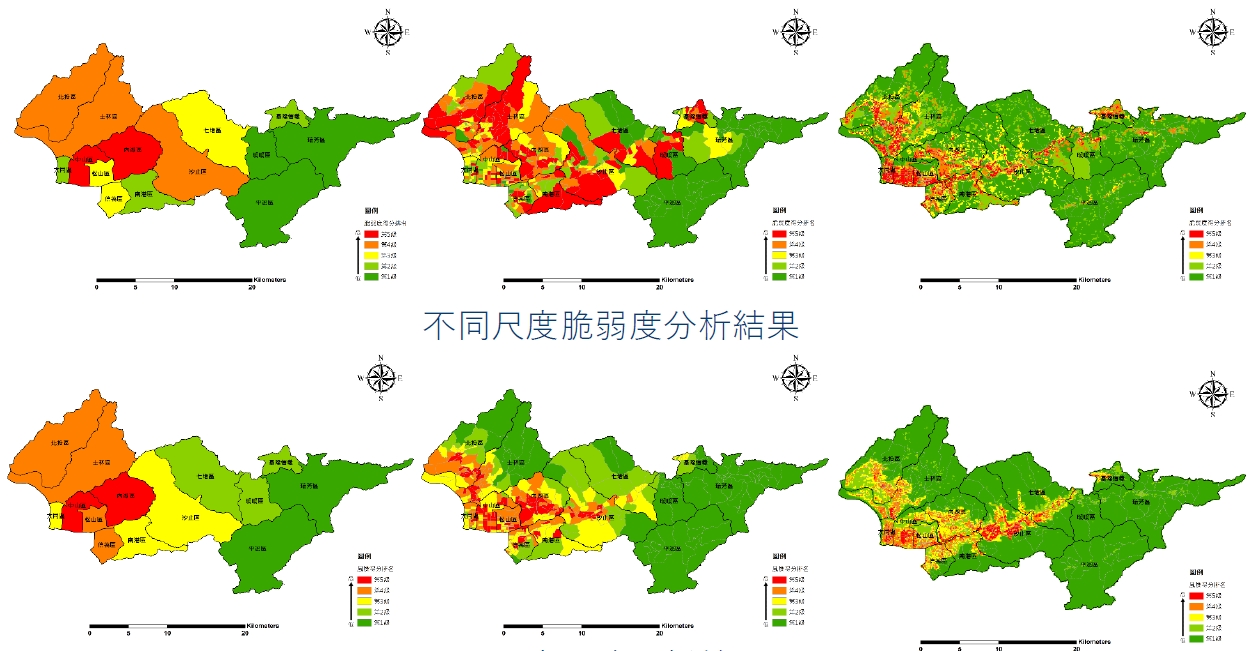
Risk analysis results of different scales