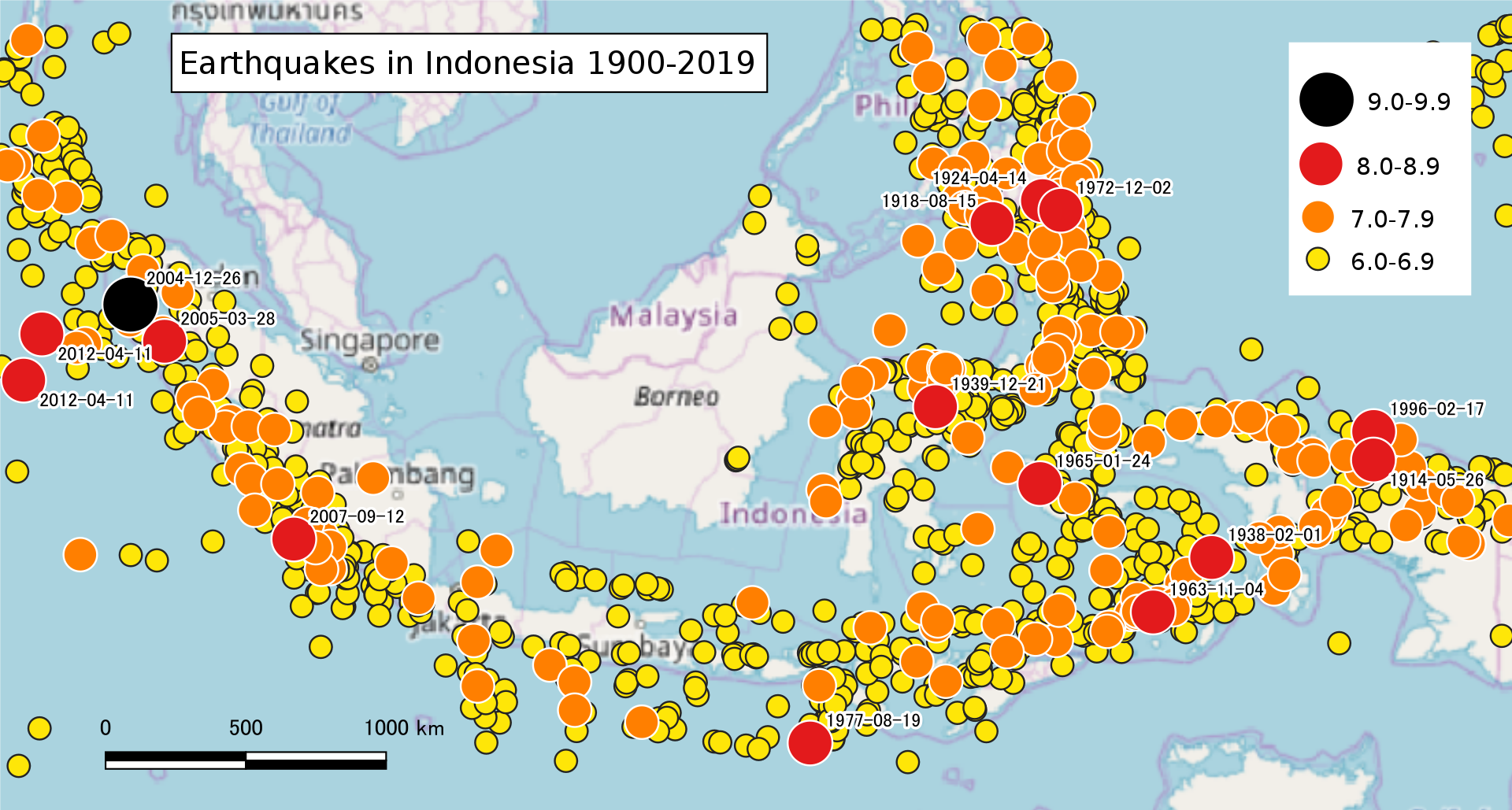
Indonesia's geographical location and climatic characteristics make it vulnerable to natural disasters. Statistics on historical disasters in the past 20 years show that there were as many as 160 flood disasters and more than 64 earthquake disasters.
Indonesia is located at the junction of the Pacific plate, the Eurasian plate, and the Indian-Australian plate. Because of its special geographical location, it has many volcanoes (there are at least 150 active volcanoes in the country) and frequent earthquakes. According to EM-DAT disaster statistics from 2000 to 2020, there are 307 natural disasters in Indonesia, the main types are: 160 floods (52.1%), 64 earthquakes (20.8%), 48 collapses (15.6%) %) and a few volcanic activities (Fig. 3). The number of people affected by disaster events is most serious in earthquake and flood disasters. The death toll from disasters, most notably earthquakes, reached 180,000 during this period.
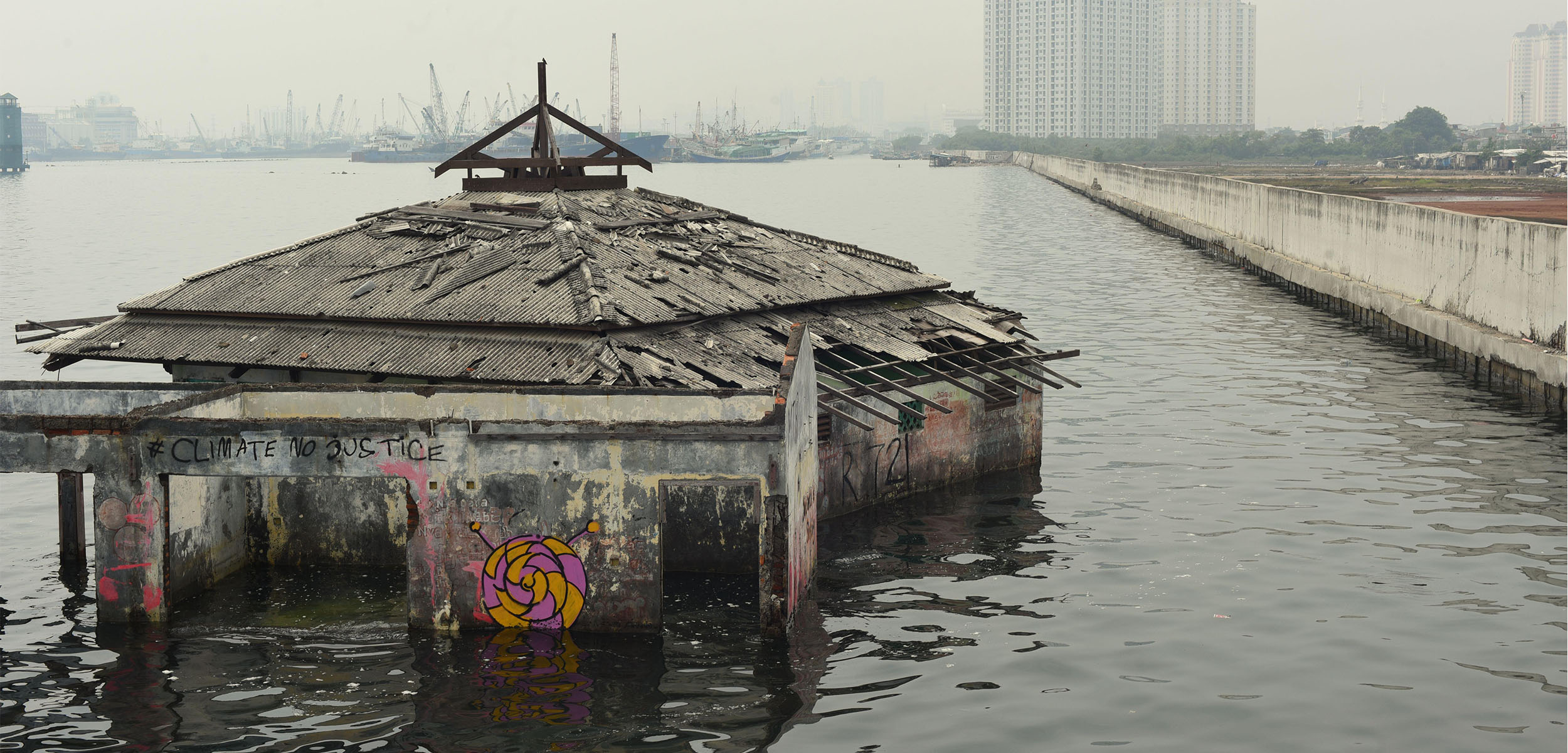
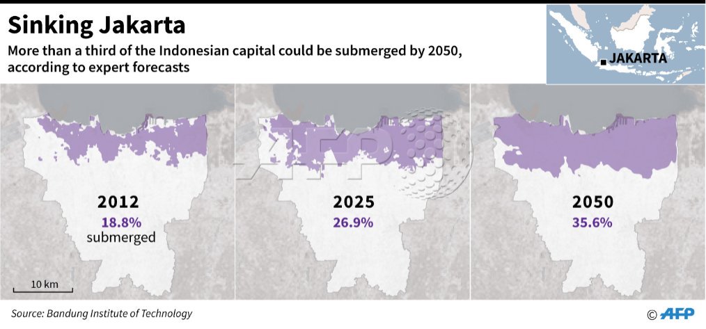
At the same time, due to the current situation in Jakarta, the capital of Indonesia, which is too congested and the infrastructure construction has not been implemented, it has caused serious traffic problems. The excessive pumping of groundwater has also caused serious ground subsidence, which can reach 15-20 cm per year, which is completely difficult to support more than 3,000 The metropolis of 10,000 people operates normally. In 2018, the Indonesian Institute of Technology Bandung (ITB) published a research survey. In the past 10 years, the stratum in North Jakarta has subsided by 2.5 meters, which is more than twice the rate of stratum subsidence in coastal cities around the world. However, the subsidence problem is not unique to North Jakarta. In West Jakarta, the average subsidence is 15 cm per year, 10 cm per year in the east, 2 cm in the central part, and 1 cm in the south. Overall, about 40% of the entire Jakarta area is now below sea level. Furthermore, according to model estimates, about 95% of the northern coastal land will be submerged by seawater by 2050. In the face of global warming, coastal port cities in all countries will face the possible impact of rising sea levels.
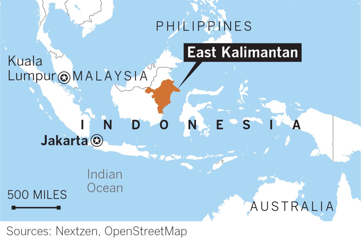
Therefore, in 2019, Indonesian President Jokowi announced “ the capital relocation plan”, and the project will start in 2021. It is expected to start the capital relocation in 2024, which will take about 10 years. Yuan). The new capital is supposed to be an area with natural bay topography near North Penajam Paser and Kutai Kartanegara in East Kalimantan, an area with natural bay terrain.
In summary, Indonesia does need neighboring countries to assist in the planning and development of its territory. However, in order to meet the needs of land development, the Indonesian government has also been conducting land surveying and resource survey work in recent years.